Cecil County, Maryland
| Cecil County, Maryland | ||
|
||
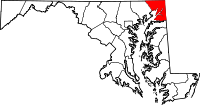 Location in the state of Maryland |
||
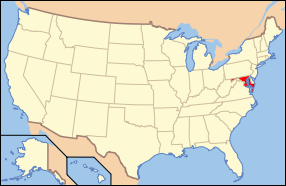 Maryland's location in the U.S. |
||
| Founded | 1674 | |
|---|---|---|
| Seat | Elkton | |
| Largest city | Elkton | |
| Area - Total - Land - Water |
418 sq mi (1,083 km²) 348 sq mi (901 km²) 70 sq mi (181 km²), 16.69% |
|
| PopulationEst. - (2007) - Density |
95,618 246/sq mi (95/km²) |
|
| Website | www.ccgov.org | |

Cecil County is a county located in the U.S. state of Maryland. It is part of the Delaware Valley. It was named for Cæcilius Calvert, 2nd Baron Baltimore (1605–1675), who was the first Proprietary Governor of the colony of Maryland from 1632 until his death in 1675. The county seat is Elkton. The newspaper of record is the Cecil Whig. As of 2000, the population was 85,951.
Contents |
Law and government
Cecil County is governed by county commissioners, the traditional form of county government in Maryland.
History
Cecil County was created in 1674 by proclamation of the Governor. It was created from portions of Baltimore and Kent Counties. One of the earliest developers of the county was George Talbot appointed Surveyor-General of Maryland in 1683, who came from Ballyconnell, County Cavan, Ireland.[1]
The county has a number of properties on the National Register of Historic Places.[2]
Geography
Cecil County, Maryland, is in the northeast corner of Maryland, south of the Pennsylvania line and west of the Delaware line. Cecil County is physically divided into two masses of land by the Chesapeake and Delaware Canal. Geographically it is part of Maryland's Eastern Shore and the Delmarva Peninsula. According to the U.S. Census Bureau, the county has a total area of 418 square miles (1,082 km²), of which 348 square miles (902 km²) is land and 70 square miles (181 km²) (16.69%) is water.
The southern part of the county lies within the Atlantic Coastal Plain and is mainly flat. North of U.S. Route 40, the terrain becomes hilly, with the most rugged hills occurring in the northwestern and north central parts of the county. The lowest elevation is sea level along the Chesapeake Bay. The highest elevation is 534 feet just below the Mason-Dixon line near Nottingham, Pennsylvania just east of U.S. Route 1.
Adjacent counties
- Chester County, Pennsylvania (northeast)
- Lancaster County, Pennsylvania (north)
- New Castle County, Delaware (east)
- Harford County (west)
- Kent County (south)
Demographics
As of the census[3] of 2000, there were 85,951 people, 31,223 households, and 23,292 families residing in the county. The population density was 247 people per square mile (95/km²). There were 34,461 housing units at an average density of 99 per square mile (38/km²). The racial makeup of the county was 93.39% White, 3.91% Black or African American, 0.33% Native American, 0.69% Asian, 0.03% Pacific Islander, 0.50% from other races, and 1.15% from two or more races. 1.52% of the population were Hispanic or Latino of any race. 17.9% were of German, 16.1% Irish, 13.8% English, 13.8% American and 6.5% Italian ancestry according to Census 2000.
There were 31,223 households out of which 37.00% had children under the age of 18 living with them, 58.60% were married couples living together, 11.10% had a female householder with no husband present, and 25.40% were non-families. 19.90% of all households were made up of individuals and 7.10% had someone living alone who was 65 years of age or older. The average household size was 2.71 and the average family size was 3.12.
In the county the population was spread out with 27.70% under the age of 18, 7.50% from 18 to 24, 31.20% from 25 to 44, 23.20% from 45 to 64, and 10.50% who were 65 years of age or older. The median age was 36 years. For every 100 females there were 98.20 males. For every 100 females age 18 and over, there were 95.70 males.
The median income for a household in the county was $50,510, and the median income for a family was $56,469. Males had a median income of $40,350 versus $28,646 for females. The per capita income for the county was $21,384. About 5.40% of families and 7.20% of the population were below the poverty line, including 9.20% of those under age 18 and 7.70% of those age 65 or over.
May 2008 the county commissioners adopted a 10% property tax increase. This is in addition to the property tax increase added by the increasing property assessments, which are increased each year and reassessed every 3 years.
Maryland state planning data suggest that the population of the county could double in the next thirty years, reaching 160,000 by 2030.[Tangel]
Public libraries
There are 7 branches of the Cecil County Public Library and the Library also does significant outreach throughout the county.
Public school system
There are 17 elementary schools, 6 middle schools,and 5 high schools, operated by Cecil County Public Schools.
Cities and towns
This county contains the following incorporated municipalities:
- Cecilton (incorporated 1864)
- Charlestown (incorporated 1742)
- Chesapeake City (incorporated 1849) (Note that despite the name, Chesapeake City is a town and not a city .)
- Elkton (incorporated 1787)
- North East (incorporated 1849)
- Perryville (incorporated 1882)
- Port Deposit (incorporated 1824)
- Rising Sun (incorporated 1860)
All eight are classified as towns under Maryland law.
The United States Census Bureau recognizes no Census-Designated Places in Cecil County, which is unusual for Maryland counties, which usually have many unincorporated population centers.
There are a few areas that aren't listed as Census Designated Places:
- Calvert
- Carpenter Point
- Childs
- Colora
- Conowingo
- Earleville
- Elk Mills
- Elk Neck
- Fair Hill
- Georgetown
- Perry Point
- Red Point
- Warwick
- White Crystal Beach
Notable residents
- Robert Alexander, born in Cecil County, delegate to the Continental Congress[4]
- John Andrews, (1746–1813), born in Cecil County, was one of the leaders of the separation of the Episcopal Church from the Anglican Church[4]
- Robert Somers Brookings, founder of the Brookings Institute
- Jacob Tome - founder of the Tome School
See also
- Cecil Whig - the local newspaper.
References
- ↑ George Johnston (1881). History of Cecil County. http://www.archive.org/details/historyofcecilco00john.
- ↑ "National Register Information System". National Register of Historic Places. National Park Service. 2008-04-15. http://www.nr.nps.gov/.
- ↑ "American FactFinder". United States Census Bureau. http://factfinder.census.gov. Retrieved 2008-01-31.
- ↑ 4.0 4.1 Who Was Who in America, Historical Volume, 1607-1896. Marquis Who's Who. 1967.
- ^ Tangel, Andrew (2006-01-10). "Hundreds discuss growth in Cecil County". The News Journal. pp. B1.
- http://www.mdp.state.md.us/MSDC/Pop_estimate/Estimate_05/county/table1a.pdf
- In MacKinlay Kantor's If the South had Won the Civil War, Cecil County secedes from Maryland to join the state of Delaware, following Maryland's secession from the Union after Lee's victory at Gettysburg.
External links
 |
Lancaster County, Pennsylvania | Chester County, Pennsylvania | |
|
| Harford County | New Castle County, Delaware | |||
| Kent County |
|
||||||||||||||
|
|||||||||||||||||||||||